Taytay (Taytay)
 |
Conurbanated with Metro Manila, it is bounded by Cainta on the north, Pasig and Taguig on the west, Antipolo in the east and Angono on the south. While economically, demographically and politically qualified, plans to convert it into a city was set aside, pending social and administrative reforms in the municipality.
The National Competitiveness Council has named Taytay as the "2nd Most Competitive Municipality (1st & 2nd Class)", for year 2019 after topping the ranking last year.
Taytay is one of the municipalities in the Philippines that has high financial capability with Php 775.3 million, making it the 2nd or 3rd Richest Municipality in the Philippines in 2016. The elevated high capacity monorail MRT Line 4 is expected to terminate at the Taytay Municipal Hall with an empty lot beside it reserved for the depot.
Taytay was a settlement situated along the coastline of the eastern side of Laguna de Bay that formed part of the Kingdom of Namayan, also known as the Kingdom of "Sapa", which was ruled by Lakan Tagkan. The said territory is what we know now as the district of Santa Ana, Manila.
Upon the arrival of the Franciscan missionaries on July 2, 1578, in Manila, they proceeded to evangelize the inhabitants of Namayan and organized it into a pueblo and named it Visita Santa Ana de Sapa. It comprised the communities of Meycatmon, Calatongdongan, Dongos, Dibag, Pinacauasan, Yamagtogon, Meysapan (Pasay), Malate, Dilao (Paco), Pandacan, Quiapo, Sampaloc, San Miguel, San Juan del Monte, San Felipe Neri (Mandaluyong), San Pedro Macati, and Taytay.
Thence, the district of Santa Ana de Sapa became the Franciscan's central mission station.
In 1579, Taytay was formally established as a town and Church in a symbiotic relation, i.e., it presupposes that one could not have existed without the other. A church was built out of light materials and called it “Visita de Santa Ana de Sapa”. Taytay—now a larger village, a pueblo, a town—came into being, as a juridical entity as well as an actual territorial unit.
Saint John the Baptist has since been the patron of the town and the parish under the ministry of the Franciscans.
The ecclesial jurisdiction of Taytay, including the visita of Cainta, which was an annex of Taytay, were transferred to the newly arrived Jesuit missionaries in 1591. They served until 1768—for 177 years.
Map - Taytay (Taytay)
Map
Country - Philippines
 |
 |
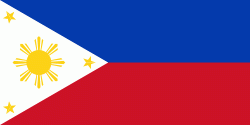
| Flag of the Philippines | |
Negritos, some of the archipelago's earliest inhabitants, were followed by successive waves of Austronesian peoples. Adoption of animism, Hinduism and Islam established island-kingdoms called Kedatuan, Rajahnates, and Sultanates. The arrival of Ferdinand Magellan, a Portuguese explorer leading a fleet for Spain, marked the beginning of Spanish colonization. In 1543, Spanish explorer Ruy López de Villalobos named the archipelago Las Islas Filipinas in honor of Philip II of Spain. Spanish settlement through Mexico, beginning in 1565, led to the Philippines becoming ruled by the Spanish Empire for more than 300 years. During this time, Catholicism became the dominant religion, and Manila became the western hub of trans-Pacific trade. In 1896, the Philippine Revolution began, which then became entwined with the 1898 Spanish–American War. Spain ceded the territory to the United States, while Filipino revolutionaries declared the First Philippine Republic. The ensuing Philippine–American War ended with the United States establishing control over the territory, which they maintained until the Japanese invasion of the islands during World War II. Following liberation, the Philippines became independent in 1946. Since then, the unitary sovereign state has often had a tumultuous experience with democracy, which included the overthrow of a decades-long dictatorship by a nonviolent revolution.
Currency / Language
| ISO | Currency | Symbol | Significant figures |
|---|---|---|---|
| PHP | Philippine peso | ₱ | 2 |
| ISO | Language |
|---|---|
| EN | English language |
| TL | Tagalog language |


